- Home ›
- Region North East England ›
- Tyne and Wear ›
- Hotels in Gateshead ›
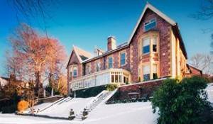
- Full Overview Eslington Villa
- Further information >
- maps & directions -
- Local Attractions -
Traveling By Car
Degrees minutes seconds (DMS)
54° 56' 9" North - 1° 36' 29" West
X (Easting) , Y (Northing)
425205,560185
Ordnance Survey Grid Reference , (also known as British National Grid (BNG)
NZ 25205 60185
what3words ///
= jelly.priced.impact
Traveling By Train
Check Prices and Times -, The Dunston Railway Station with a station code of DOT is approximately 1.6 miles away, direct line, point to point note: may be longer by road
The Gateshead Stadium underground / light rail stop at postcode NE8 3NX is approximately 1.7 miles away on the Green Yellow line - the Tyne and Wear Metro service
Other Grid references:
Degrees minutes seconds (DMS)
54° 56' 9" North - 1° 36' 29" West
X (Easting) , Y (Northing)
425205,560185
Ordnance Survey Grid Reference , (also known as British National Grid (BNG)
NZ 25205 60185
what3words ///
= jelly.priced.impact