Hotel Finder UK

HOTEL FINDER UK

Hotel Finder UK

Maps & Directions to The Turks Head NE65 7TE

🛈  Top tip - you can also search for National Parks and Areas of Outstanding Natural Beauty (AONB’s)
  1. Home
  2. Region North East England
  3. Northumberland
  4. Hotels in Morpeth
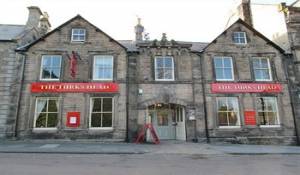
  5. Full Overview The Turks Head

The Turks Head


High Street
Rothbury
Morpeth
Northumberland
England
NE65 7TE
United Kingdom.

The Turks Head  Maps  travelling by car Traveling By Car
Get Driving Directions to
The Turks Head
- Enter a start Postcode
The Turks Head  Maps  title= Traveling By Train Check Prices and Times -, The Acklington Railway Station with a station code of ACK is approximately 10.3 miles away, direct line, point to point note: may be longer by road

Other Grid references:


Degrees minutes seconds (DMS)
55 deg, 18 min, 34 secs North - 1 deg, 54 min, 46 secs West

X (Easting) , Y (Northing)
405621,601721

Ordnance Survey Grid Reference , (also known as British National Grid (BNG)
NU 05621 01721

what3words ///
What 3 Words = kettles.roadblock.walked