- Home ›
- Region West Midlands ›
- Herefordshire ›
- Hotels in Ledbury ›
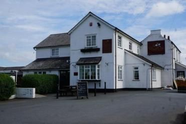
- Full Overview Shepherds Gate at The Royal Oak
- Further information >
- maps & directions -
- Local Attractions -
Traveling By Car
Degrees minutes seconds (DMS)
52° 0' 18" North - 2° 29' 36" West
X (Easting) , Y (Northing)
366235,234162
Ordnance Survey Grid Reference , (also known as British National Grid (BNG)
SO 66235 34162
what3words ///
= cobble.ridiculed.guises
Traveling By Train
Check Prices and Times -, The Ledbury Railway Station with a station code of LED is approximately 4.0 miles away, direct line, point to point note: may be longer by road
Other Grid references:
Degrees minutes seconds (DMS)
52° 0' 18" North - 2° 29' 36" West
X (Easting) , Y (Northing)
366235,234162
Ordnance Survey Grid Reference , (also known as British National Grid (BNG)
SO 66235 34162
what3words ///
= cobble.ridiculed.guises